
Visita las Cuevas del Rey en esta ruta de senderismo alrededor del Bentaiga y viaja al tiempo de los primeros pobladores de Gran Canaria.
Technical Specifications

- Difficulty: moderate.
- Distance: 10.2 km.
- Travel time: 3hours without stops (5.5 hours with stops).
- Elevation gain:635 m.
- Starting Point:Parking lot next to the base of Bentaiga.
- End:Parking lot next to the base of Bentaiga.
- Date completed (photos): February, 2019 (before the wildfires that burned a large part of Gran Canaria in the summer of the same year).
Our loop hike between Bentaiga, Cuevas del Rey, and La Solana
Technical stop in Tejeda

Before setting out on the hike, we stopped in Tejeda, the highest village on the island of Gran Canaria, and stocked up on ingredients for our sandwiches (freshly baked bread, cheese, guacamole, etc.).
Since we were there anyway, we stopped by one of Tejeda's most famous bakeries, Dulcería Nublo, to buy some of their delicious almond cookies and a cake to recharge our batteries.
Start of the route

We were lucky and found a parking spot right at the start of the trail, at a small overlook facing Tejeda.
And with those views before us, we set out along the GC-607 highway, which circles the northern face of Roque Bentaiga.
The road has almost no shoulder, but there's very little traffic (or at least there was in mid-February), so this wasn't a problem.

As you can see in the photos, there were still almond trees in bloom at that time of year. They were the icing on the cake of our walk. 🙂
The landscape becomes increasingly dramatic and beautiful as you approach the Cuevas del Rey, especially from certain scenic overlooks along the road (I've marked them on the map at the end of this post).
Visit to the Cuevas del Rey

When you reach a small cluster of houses (where you can buy some delicious goat cheese, by the way), you'll come to the entrance to the Cuevas del Rey de Tejeda.
This is a unique archaeological site featuring up to 80 caves carved into the Roque de Cuevas del Rey by the island's earliest settlers.
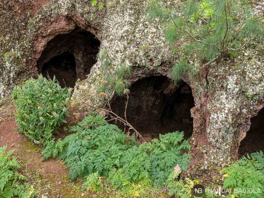
The path is steep and narrow (deliberately designed that way for defensive reasons), but ropes and handholds have been installed so that visitors can explore part of the caves without any trouble—as long as you have no physical limitations that would prevent you from walking.
You can still see engravings and paintings on the stone walls, indentations in the floor that served as cooking pots, and holes for fitting wooden cots, doors, and windows.

Admission is free, and I highly recommend it.
Descent to La Solana
After driving around the Roque de Cuevas del Rey, you'll come upon the view of the Roque Nublo on the other side of the ravine.

Take a right turn onto a dirt road (on the map at the bottom of the page, this is where the yellow line begins).
While you're there, you can take the opportunity to grab a bite to eat while resting on a large rock overlooking the sea above the Chorrillo Ravine.
You'll pass by some beehives.

Canarian mountain honey tastes delicious, but it's best to try it at a store in Tejeda or the surrounding area.
It'll be safer than getting too close to these beehives. 😉
After a few minutes walking cross-country, you'll reach the La Solana cemetery, and from there, the town.

Hike to Espinillo
If your feet hurt, take the opportunity to rest at La Solana, because from here on out, it's all uphill.

That said, the views are beautiful, with the Bentaiga on the left and the Roque Nublo on the right.
Halfway up the climb, you'll reach Espinillo, where you can visit a lookout point marked by a stone cross.

Back to the top
From here on, you continue climbing in a zigzag pattern.
You'll cross the road at one point, but I recommend sticking to the dirt road (not the paved one) since that route is shorter.
And just when you least expect it, you'll reach the base of Bentaiga, completing the loop trail.

Wikiloc Itinerary
Want to follow this route on Wikiloc?
You can view the trail on the map at this link.
Note: When we entered the Cuevas del Rey, the GPS went a little haywire. That’s why, on the map, in addition to the loop trail, you’ll see some lines that are too straight and too far apart to be real. Don’t pay any attention to them. 🙂
What to bring

- Food: if it's going to be a long day, remember to pack sandwiches, fruit, nuts...
- Water: I recommend bringing at least 1.5 liters of water per person.
- A bag: to pack out all the trash you generate. Please help keep this wonderful place clean!
- Sun protection: sunscreen, a cap, sunglasses... the usual essentials.
- Comfortable footwear: hiking boots with a sturdy sole that can handle the rough volcanic terrain.
Where to sleep
Speaking of caves…
If you're in the area, why not try spending the night in a Canarian cave house?
I'll give you all the details in the post dedicated to Fagajesto (very close to Bentaiga).

Useful links
- Rent Casa Lola.
- Other hotel deals in Gran Canaria.
- Flight deals to the Canary Islands: Trabber, eDreams, Momondo, and Vueling.
- 5% discount when booking your adventure travel insurance with IATI.

Road tripping through the Canary Islands? Check out these posts:
- Stay in a Canarian house across from the Sao Ravine.
- Trail from Artenara to Cuevas del Caballero and Los Candiles.
- Visit Lanzarote, the land of fire.
Map
Any questions about this loop trail around Roque Bentaiga? Feel free to ask in the comments. 😉